Data Services
Visual Intelligence.
Build your own map data with GeoCam, or let us produce it for you. From raw imagery to finished GIS, CAD, and BIM data.
Imagery as a Service
Complete reality capture delivered as a managed service. Includes 3D Textured Meshes, Point Clouds, and Orthorenders, all optimised for Australian coordinate systems and standards.
CAD & GIS Data
We offer data services, custom Map and CAD data production at almost any Level of Detail (LOD). Turning raw imagery into precise vector data for Councils, Utilities, and Construction projects.
Self-Service Option
Build your own map data with the GeoCam Editor.
GeoCam Editor enables the creation of map features directly from your orientated imagery. Connect with your Esri ArcGIS Feature Services and create features into almost any data model.
Create Map and CAD Data using 3D Reconstructions. Single-click feature creation from immersive 360° imagery.
See the Editor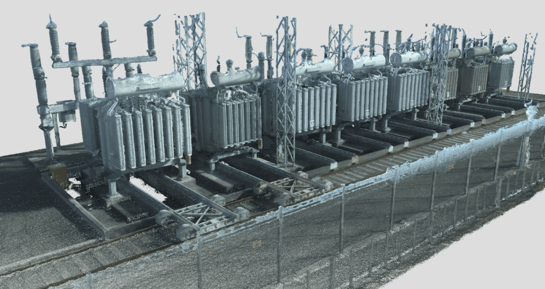
Industries Served
What we map.
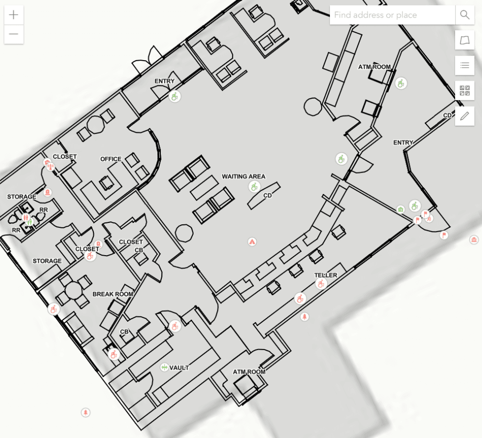
Public Safety
Fire and Police Pre Plans
Floor plans, critical assets, access points, and hydrant locations for Fire, Police, and Ambulance Services.
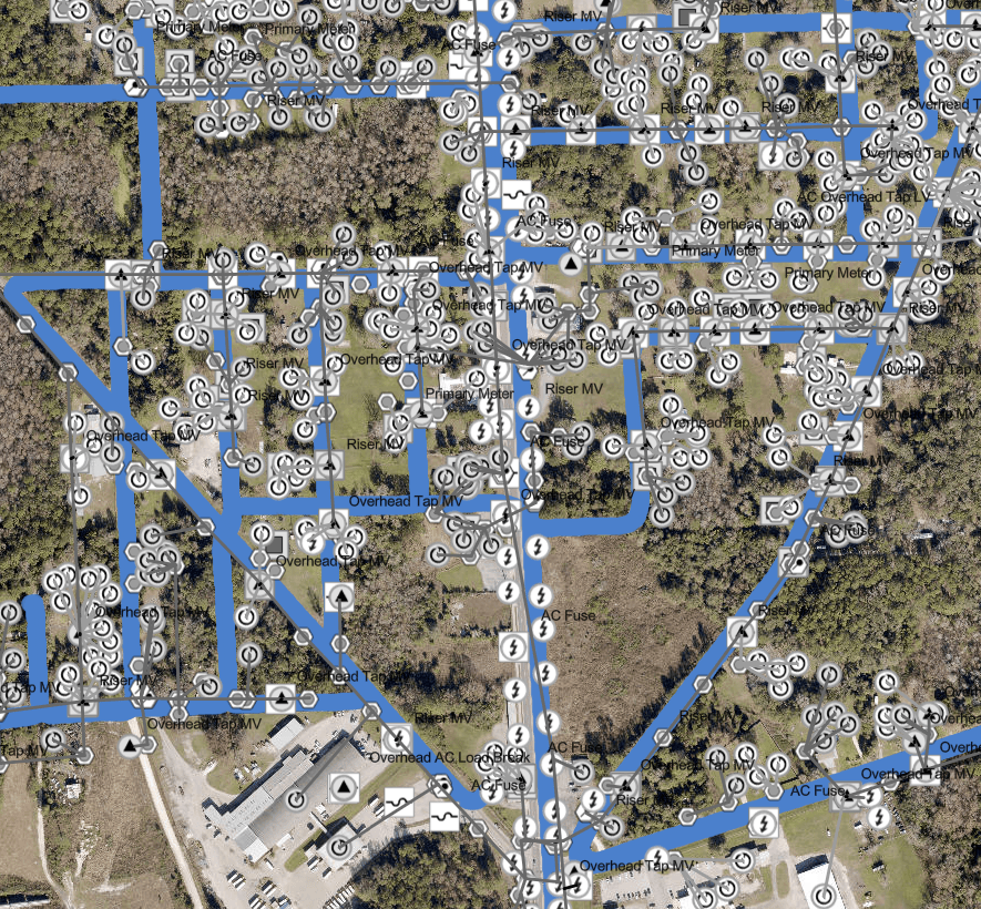
Telecommunications
Fiber Network Assets
Poles, attachments, connectivity, strand counts, and more. Complete OSP asset capture from vehicle or backpack.
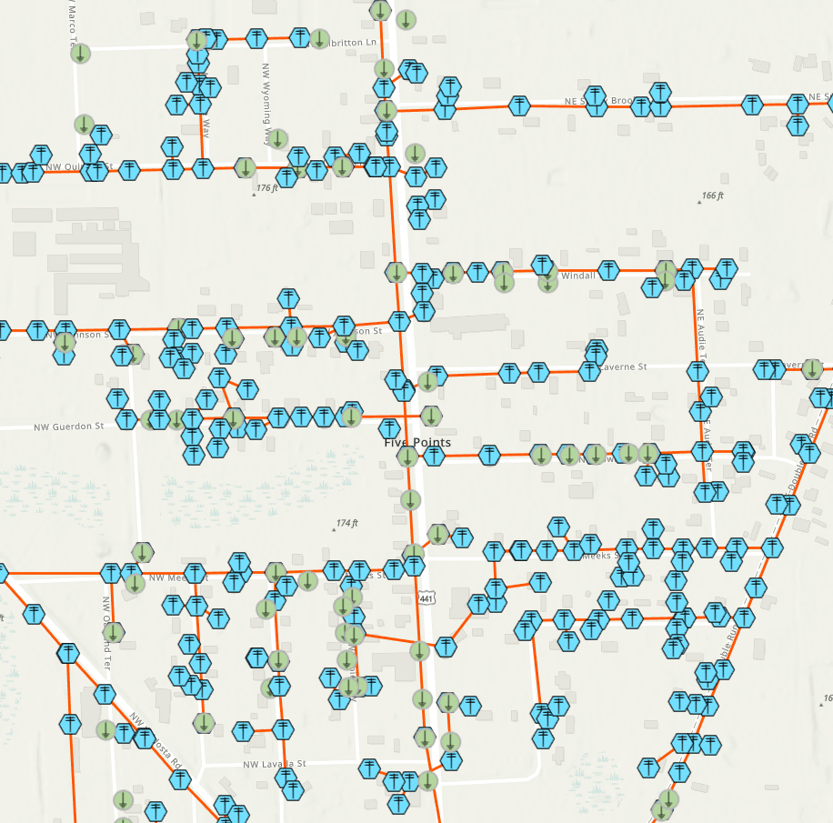
Electric Utilities
Distribution Network Assets
Structures, devices, structure junctions, electric line and sub-networks. Compliant with ArcGIS Utility Network.

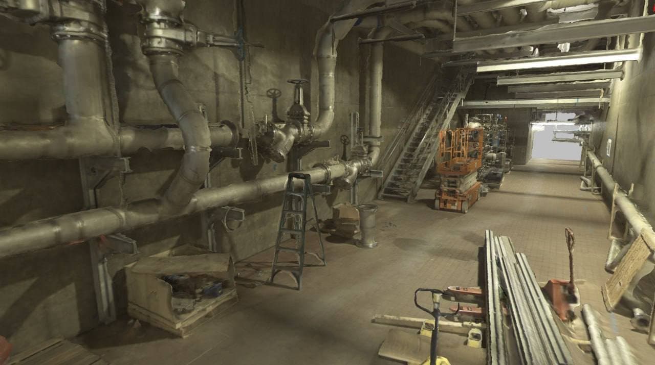
Facilities
Indoor Facilities Management
Architectural floor plans and asset locations captured via backpack. Ideal for campuses, hospitals, and government buildings.
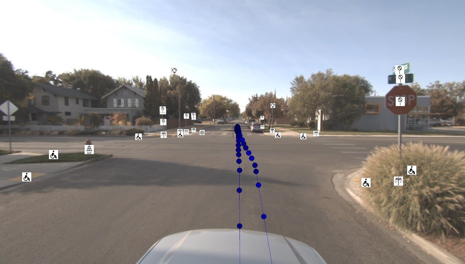
Public Works
Street and Road Assets
Signs by type, poles, signals, streetlights, storm water infrastructure. Condition assessment ready.
3D Outputs
Export 3D Textured Meshes and derivatives.
Export 3D Textured Meshes from the GeoCam platform and a package of derivatives, including Point Clouds and Orthorenders. Compatible with major GIS, CAD, and BIM platforms.
Talk to us about your data requirements.
Whether you want to self-serve with the Editor or have us deliver finished GIS data, we can tailor a solution for your project.
Contact Us